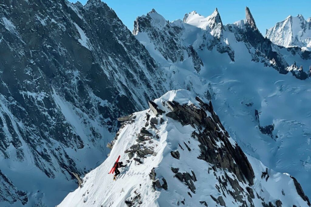
On the 4th of February, Gaspard Ravanel and his team mapped out a new variant of a ski and snowboard descent on the south face of the aiguille de Talèfre in the Mont-Blanc massif. It was an adventurous, technical and solitary day, guided by an intuition born of Google Earth. The snowboarder tells us all about it.
“I paraglided to the Leschaux hut while my friends went ski touring, we slept at the hut and set off just before sunrise the next morning. This enabled us to reach the summit of the Aiguille de Talèfre just before noon”, says Gaspard Ravanel. On the 4th of February, accompanied by Tim Roche, Taôma Carcuac and Tim Guala, the snowboarder opened a new variant of the descent of the south face of the Aiguille de Talèfre, in the Mont-Blanc massif.
He on a snowboard, the other three on skis, they ventured into